
 Euro Truck Simulator 2
 American
Truck Simulator
American
Truck Simulator
Allan's World Background Map 4K - Dark - ETS2
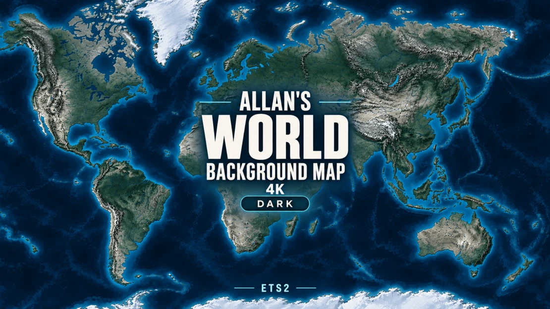
Allan's World Background Map 4K - Dark - ETS2
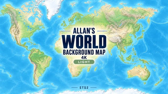
A detailed dark world background for Euro Truck Simulator 2, with deep navy oceans, slate terrain and silver unexplored roads. Preserves the geography, original islands, detail and balanced zoom levels of the Light edition.
Includes original islands for Grand Utopia, Vanemap and Pj Indo, plus a separate fictional frozen island for the Antarctica map mod. The frozen island does not represent the real Antarctic continent.
FullScreen Maps is an optional companion from GMC Community. If you use it, load it above this background in your mod load order.
Enable only one background map (Light or Dark), and disable the local copy if using the Workshop version. Playable roads are supplied by your map mods; their scale and placement may not match real geography exactly.
Built for the ETS2 1.61 setup. World Map zooms: 100,000 / 50,000 / 15,000 / 5,000.
Credits
Created by Allan. Geography: Natural Earth (public domain). Terrain: Mapzen/Tilezen Terrain Tiles.
Adapted by Allan: geographic reprojection, regional fitting, relief shading, dark navy/slate colour grading, original fictional islands and texture compression. Source providers do not endorse these modifications. This is a game background, not a navigational or survey map.
Terrain provider acknowledgements
• ArcticDEM terrain data DEM(s) were created from DigitalGlobe, Inc., imagery and funded under National Science Foundation awards 1043681, 1559691, and 1542736.
• Australia terrain data © Commonwealth of Australia (Geoscience Australia) 2017.
• Austria terrain data © offene Daten Österreichs – Digitales Geländemodell (DGM) Österreich.
• Canada terrain data contains information licensed under the Open Government Licence – Canada.
• Europe terrain data produced using Copernicus data and information funded by the European Union – EU-DEM layers.
• Global ETOPO1 terrain data: U.S. National Oceanic and Atmospheric Administration.
• Mexico terrain data source: INEGI, Continental relief, 2016.
• New Zealand terrain data Copyright 2011 Crown copyright (c) Land Information New Zealand and the New Zealand Government (All rights reserved).
• Norway terrain data © Kartverket.
• United Kingdom terrain data © Environment Agency copyright and/or database right 2015. All rights reserved.
• United States 3DEP (formerly NED) and global GMTED2010 and SRTM terrain data courtesy of the U.S. Geological Survey.
Global NOAA source credit: DOC/NOAA/NESDIS/NCEI > National Centers for Environmental Information, NESDIS, NOAA, U.S. Department of Commerce. Incorporated US government material is not subject to copyright protection within the United States.
Sources and licence information
https://www.naturalearthdata.com/about/terms-of-use/
https://www.naturalearthdata.com/downloads/10m-raster-data/10m-natural-earth-2/
https://registry.opendata.aws/terrain-tiles/
https://github.com/tilezen/joerd/blob/master/docs/attribution.md
Display-coordinate reference:
https://github.com/simroads/ts-map/blob/master/TsMap/Helper.cs
2026-10-13
Allan’s World Background Map 4K — V1.8HZ
Applies to Light, Dark and Dark Coloured, in both Normal and High Zoom editions.
- Repositioned the main Tasmania island to align with the GMC Tasmania Inset Fix.
- Removed the surrounding Tasmania inset box and caption.
- Preserved each edition’s existing colours, terrain detail, coastline corrections, UK alignment, zoom settings and optional colour-pack support.
- Retained Dark Coloured V1.7 country borders and included them in the High Zoom edition.
- Updated version names and descriptions.
For Tasmania, use GMC Tasmania Fix immediately above Australia Tasmania map FIX. The fix itself is unchanged; retain the required Tasmania definition/model files and applicable compatibility fixes. Replace the previous background adaptation rather than enabling both.
Activate only one background edition.
2026-09-24
V1.6.1HZ — High Zoom Editions
• Improved road colours on the job-selection map: amber for explored roads and grey for unexplored roads. Light retains a darker grey for contrast.
• Preserved compatibility with Jacob’s SCS UI Tweaks. Compatible colour packs placed above the background retain their own colours; without one, the background uses its own defaults.
• Updated artwork to remove release numbers.
High Zoom settings remain unchanged: 100,000 → 30,000 → 5,000 → 1,000, from furthest out to closest in.
Terrain, coastline corrections and UK map alignment are unchanged.
Available in Light, Dark and Dark Coloured. Each High Zoom edition is a complete alternative to Standard—enable only one background edition/version at a time.
2026-09-24
V1.6.1 / V1.6.1HZ — Clearer job-map road colours
• Improved explored and unexplored road colours on the job-selection map: amber for explored roads and grey for unexplored roads.
• Light editions retain a darker grey for better contrast.
• Compatibility with Jacob’s SCS UI Tweaks is preserved. Compatible colour packs placed above the background retain their own colours; without one, the background uses its own defaults.
• Updated artwork to remove release numbers.
Terrain, coastline corrections, UK alignment and existing zoom settings are unchanged. Standard and High Zoom remain separate complete editions.
Enable only one background edition/version at a time.
2026-09-23
V1.6HZ — High Zoom Edition
• Added support/compatibility for Jacob’s SCS UI Tweaks for ATS and ETS2.
• Retained the High Zoom settings: 100,000 → 30,000 → 5,000 → 1,000, from furthest out to closest in.
• Preserved existing terrain artwork, coastline corrections, UK map alignment and default colours.
• Corrected outdated thumbnail version labels and updated installation guidance.
Jacob’s SCS UI Tweaks is a collection of 9 individual UI colour packs that work across both games. The download also includes two support packages for the base UI map—one for each game.
Colour packs are optional and downloaded separately. Place your chosen compatible colour pack above this background and follow Jacob’s installation instructions. Without a colour pack, the background retains its default colours.
V1.6HZ is a complete background-map edition, not an addon. Enable either Standard or High Zoom—never both. FullScreen Maps is optional and also goes above the background.
2026-09-23
ETS2 V1.6 / V1.6HZ — Light, Dark and Dark Coloured
• Added support/compatibility for Jacob’s SCS UI Tweaks for ATS and ETS2.
• Preserved existing terrain artwork, coastline corrections, UK map alignment and each edition’s zoom settings.
• Preserved default colours when no colour pack is installed.
• Corrected outdated thumbnail version labels and updated installation guidance.
Jacob’s SCS UI Tweaks is a collection of 9 individual UI colour packs that work across both games. The download also includes two support packages for the base UI map—one for each game.
Colour packs are optional and downloaded separately. Place your chosen compatible colour pack above the background and follow Jacob’s installation instructions.
Enable only one background edition at a time. Standard and HZ are separate complete editions—choose one. FullScreen Maps is optional and also goes above the background.
2026-09-19
🗺️ Allan’s ETS2 Background Maps — V1.5HZ High Zoom Edition
A closer view for more precise route planning!
V1.5HZ introduces an extended zoom range, making it easier to see individual roads, junctions and motorway ramps while retaining the existing wide overview.
🔍 Four zoom levels — furthest to closest:
100,000 → 30,000 → 5,000 → 1,000
The familiar background artwork, colours, map alignment and texture resolution are preserved. The terrain will naturally look softer at the closest zoom because it is being magnified further.
📦 HZ is a separate edition. The standard V1.5 zoom settings remain unchanged, so you can choose the version you prefer.
⚠️ Enable only one background-map edition at a time. Replace your standard background with the matching HZ edition in the same load-order position.

2026-09-17
V1.5 – Coastal and Island Update
• Improved background coastline alignment around Visby/Gotland and southeast Iceland near Reyðarfjörður and Höfn.
• Refined eastern Orkney near Kirkwall, southern Kuressaare, Ventspils and the Curonian Spit near Zelenogradsk.
• Improved the northern shore around Patras and local shorelines around Argostoli, including the southwest access road and terminal area.
• Retained the earlier UK, Wick, Exeter, Azov, France and Corsica corrections.
• Preserved surrounding islands and water channels, with Iceland’s map-texture join checked for continuity.
• Retained the existing Light colours, terrain detail, resolution and zoom settings.
Known remaining issue: the larger Birsay road-loop mismatch is unresolved. Minor coastal offsets remain in some areas.
The version remains V1.5. Activate only one background-map edition at a time.
2026-09-16
V1.4 — World Map Compatibility Fix
- Fixed the background’s interface mismatch that could display “no_gps_different_mode” on ETS2 1.60.
- Uses the game’s own World Map interface.
- One package per edition for ETS2 1.60 and 1.61.
- Terrain textures, placements, colours and zoom settings remain unchanged.
Use only one background map at a time. Separate UI or Fullscreen mods can override the World Map interface.
2026-09-15
V1.3 — Dark Edition
• Refined coastlines, islands, lakes and riverbanks across Europe, North Africa, the Red Sea, Southeast Asia and South America.
• Improved placement around Britain and Ireland, the Hebrides, Faroes, Baltic, Mediterranean and Turkey.
• Added Sprogø to better match Denmark’s Great Belt crossing.
• Refined the Ceuta shoreline and Georgetown estuary around local roads and bridge crossings.
• Updated the Dark edition to match the Light edition’s revised geography while preserving its dark colour scheme.
Texture resolution, zoom levels and background-map controls remain unchanged.
Some small coastal and river-edge offsets remain, and placement can vary between map combinations. Enable only one background map at a time.
2026-09-13
V1.0 - Background map update
Improved map alignment across Africa, EAA and other supported regions.
Adjusted Halifax and Newfoundland and refined the coast around Valdivia, Vina del Mar and Barcelona in EAA.
Added small land areas around Kuah and Phuket/Kathu.
Kept the existing terrain detail and Grand Utopia and Vanemap support.
Some coastal alignment work is still ongoing.
2026-09-12
First public release of the Dark edition.
2026-10-13
Allan’s World Background Map 4K — V1.8HZ
Applies to Light, Dark and Dark Coloured, in both Normal and High Zoom editions.
- Repositioned the main Tasmania island to align with the GMC Tasmania Inset Fix.
- Removed the surrounding Tasmania inset box and caption.
- Preserved each edition’s existing colours, terrain detail, coastline corrections, UK alignment, zoom settings and optional colour-pack support.
- Retained Dark Coloured V1.7 country borders and included them in the High Zoom edition.
- Updated version names and descriptions.
For Tasmania, use GMC Tasmania Fix immediately above Australia Tasmania map FIX. The fix itself is unchanged; retain the required Tasmania definition/model files and applicable compatibility fixes. Replace the previous background adaptation rather than enabling both.
Activate only one background edition.
2026-09-24
V1.6.1HZ — High Zoom Editions
• Improved road colours on the job-selection map: amber for explored roads and grey for unexplored roads. Light retains a darker grey for contrast.
• Preserved compatibility with Jacob’s SCS UI Tweaks. Compatible colour packs placed above the background retain their own colours; without one, the background uses its own defaults.
• Updated artwork to remove release numbers.
High Zoom settings remain unchanged: 100,000 → 30,000 → 5,000 → 1,000, from furthest out to closest in.
Terrain, coastline corrections and UK map alignment are unchanged.
Available in Light, Dark and Dark Coloured. Each High Zoom edition is a complete alternative to Standard—enable only one background edition/version at a time.
2026-09-24
V1.6.1 / V1.6.1HZ — Clearer job-map road colours
• Improved explored and unexplored road colours on the job-selection map: amber for explored roads and grey for unexplored roads.
• Light editions retain a darker grey for better contrast.
• Compatibility with Jacob’s SCS UI Tweaks is preserved. Compatible colour packs placed above the background retain their own colours; without one, the background uses its own defaults.
• Updated artwork to remove release numbers.
Terrain, coastline corrections, UK alignment and existing zoom settings are unchanged. Standard and High Zoom remain separate complete editions.
Enable only one background edition/version at a time.
2026-09-23
V1.6HZ — High Zoom Edition
• Added support/compatibility for Jacob’s SCS UI Tweaks for ATS and ETS2.
• Retained the High Zoom settings: 100,000 → 30,000 → 5,000 → 1,000, from furthest out to closest in.
• Preserved existing terrain artwork, coastline corrections, UK map alignment and default colours.
• Corrected outdated thumbnail version labels and updated installation guidance.
Jacob’s SCS UI Tweaks is a collection of 9 individual UI colour packs that work across both games. The download also includes two support packages for the base UI map—one for each game.
Colour packs are optional and downloaded separately. Place your chosen compatible colour pack above this background and follow Jacob’s installation instructions. Without a colour pack, the background retains its default colours.
V1.6HZ is a complete background-map edition, not an addon. Enable either Standard or High Zoom—never both. FullScreen Maps is optional and also goes above the background.
2026-09-23
ETS2 V1.6 / V1.6HZ — Light, Dark and Dark Coloured
• Added support/compatibility for Jacob’s SCS UI Tweaks for ATS and ETS2.
• Preserved existing terrain artwork, coastline corrections, UK map alignment and each edition’s zoom settings.
• Preserved default colours when no colour pack is installed.
• Corrected outdated thumbnail version labels and updated installation guidance.
Jacob’s SCS UI Tweaks is a collection of 9 individual UI colour packs that work across both games. The download also includes two support packages for the base UI map—one for each game.
Colour packs are optional and downloaded separately. Place your chosen compatible colour pack above the background and follow Jacob’s installation instructions.
Enable only one background edition at a time. Standard and HZ are separate complete editions—choose one. FullScreen Maps is optional and also goes above the background.
2026-09-19
🗺️ Allan’s ETS2 Background Maps — V1.5HZ High Zoom Edition
A closer view for more precise route planning!
V1.5HZ introduces an extended zoom range, making it easier to see individual roads, junctions and motorway ramps while retaining the existing wide overview.
🔍 Four zoom levels — furthest to closest:
100,000 → 30,000 → 5,000 → 1,000
The familiar background artwork, colours, map alignment and texture resolution are preserved. The terrain will naturally look softer at the closest zoom because it is being magnified further.
📦 HZ is a separate edition. The standard V1.5 zoom settings remain unchanged, so you can choose the version you prefer.
⚠️ Enable only one background-map edition at a time. Replace your standard background with the matching HZ edition in the same load-order position.
2026-09-17
V1.5 – Coastal and Island Update
• Improved background coastline alignment around Visby/Gotland and southeast Iceland near Reyðarfjörður and Höfn.
• Refined eastern Orkney near Kirkwall, southern Kuressaare, Ventspils and the Curonian Spit near Zelenogradsk.
• Improved the northern shore around Patras and local shorelines around Argostoli, including the southwest access road and terminal area.
• Retained the earlier UK, Wick, Exeter, Azov, France and Corsica corrections.
• Preserved surrounding islands and water channels, with Iceland’s map-texture join checked for continuity.
• Retained the existing Light colours, terrain detail, resolution and zoom settings.
Known remaining issue: the larger Birsay road-loop mismatch is unresolved. Minor coastal offsets remain in some areas.
The version remains V1.5. Activate only one background-map edition at a time.
2026-09-16
V1.4 — World Map Compatibility Fix
- Fixed the background’s interface mismatch that could display “no_gps_different_mode” on ETS2 1.60.
- Uses the game’s own World Map interface.
- One package per edition for ETS2 1.60 and 1.61.
- Terrain textures, placements, colours and zoom settings remain unchanged.
Use only one background map at a time. Separate UI or Fullscreen mods can override the World Map interface.
2026-09-15
V1.3 — Dark Edition
• Refined coastlines, islands, lakes and riverbanks across Europe, North Africa, the Red Sea, Southeast Asia and South America.
• Improved placement around Britain and Ireland, the Hebrides, Faroes, Baltic, Mediterranean and Turkey.
• Added Sprogø to better match Denmark’s Great Belt crossing.
• Refined the Ceuta shoreline and Georgetown estuary around local roads and bridge crossings.
• Updated the Dark edition to match the Light edition’s revised geography while preserving its dark colour scheme.
Texture resolution, zoom levels and background-map controls remain unchanged.
Some small coastal and river-edge offsets remain, and placement can vary between map combinations. Enable only one background map at a time.
2026-09-13
V1.0 - Background map update
Improved map alignment across Africa, EAA and other supported regions.
Adjusted Halifax and Newfoundland and refined the coast around Valdivia, Vina del Mar and Barcelona in EAA.
Added small land areas around Kuah and Phuket/Kathu.
Kept the existing terrain detail and Grand Utopia and Vanemap support.
Some coastal alignment work is still ongoing.
2026-09-12
First public release of the Dark edition.

Other Mods for Euro Truck Simulator 2
![[1.54]Yet Another Beyond Fix](https://storage.truckymods.io/public/projects/yet-another-beyond-fix/media/fba53e1c8ee758341a659d1f324214a5.webp)

![[OBSOLETE] Road to Asia 1.3.2 Semaphore Fix](https://storage.truckymods.io/public/projects/road-to-asia-132-semaphore-fix/media/5863c46c936bba5e836a4bf6c3980ae6.webp)
![[OBSOLETE]Trans-Siberian Truckway-Beyond RC Sibir Map 2.10 Fix](https://storage.truckymods.io/public/projects/trans-siberian-truckway-beyond-rc-sibir-map-210-fix/media/4ce6d892bcb4b7885dbb07c36002f0fb.webp)
This Euro Truck Simulator 2 add-on was created by Allan C. and shared in UI for Euro Truck Simulator 2.